GPS Antennas:

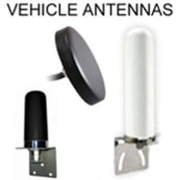
Marine Grade options: All of the styles in our GPS antennas category that are "vehicle mount" type are suitable for marine, because they attach flush to a flat surface and have a durable ABS radome: The "puck" styles and also the cone style: ALGLNA2c3FT/ 9ft /18ft:

Frequency Bands

The signals produced by GPS satellites comprise ranging signals and navigation messages which provide time and spatial data. This data can be received by GPS antennas operating on the following key frequency bands (nb. there are additional legacy bands and modernized signals) which are available for civilian use and are derived from the fundamental frequency of the atomic clocks contained on the orbiting satellites:

  1. L1 1575.42 MHz and of 15.345 MHz bandwidth
  2. L2 1227.6 MHz and 11 MHz bandwidth
  3. L5 1176.45 MHz and 12.5 MHz bandwidth

Conversion to Iridium Satellite Coverage: For all of our antennas that cover the GPS frequency 1.5GHz: We can convert the 1.5GHz GPS antenna to 1.6GHz in order to cover the Iridium (Satellite) frequency. This customization takes about 4 extra weeks in production and will increase the cost of the antenna by $1.75 per antenna.

GPS Antennas

Global Positioning Satellite (GPS) Antennas are radio-frequency devices that are designed and configured for the receipt and amplification of the microwave signals that are transmitted by GPS satellites.

The GPS signal received is converted by the antenna into an electronic signal which can be utilized as navigational data by a GPS receiving device to compute a position.

GPS is primarily a proprietary military satellite-dependent radio-navigation system, owned by the United States Government and operated by the Federal entity, the United States Space Force. First implemented in the 1970s, the project has grown and matured to support up to 31 actively orbiting satellites, with global coverage and pinpoint accuracy of within 30 centimeters (11.81 inches).

Originally known as Navstar GPS, this system is one of a number of Global Navigation Satellite Systems (GNSS) that are available worldwide with military, and civilian applications, including emergency services, marine, automotive and aviation. Civilian access to GPS is at the discretion of the US Government and can be limited and withdrawn at their discretion with notable periods of selective accessibility or degradation of the service in previous years.

GPS is not the only satellite-based radio-navigational system in existence. The following are other GNSS that also have compatibility with GPS:

  • GLObal NAvigation Satellite System (GLONASS), a Russian system that is currently the main alternative to GPS. GLONASS and GPS radio-navigational data can be used simultaneously by GPS antennas meaning that a larger number of satellites are available for positioning and locations can be pinpointed with more speed and accuracy.
  • The Galileo Positioning System developed by the European Union. Upgrades to the GPS system allows interoperability with Galileo.
  • BeiDou Navigation Satellite System from China.
  • NAVigation with Indian Constellation (NAVIC)developed by India.

The data transmitted on the GPS frequencies include:

  • Ephemeris data - positional data for each orbiting satellite.
  • Almanac - data on the status of the GPS satellite constellation as a whole.
  • Pseudorandom noise (PRN).
  • Precision code or precision positioning service.

The L frequency bands involved are able to penetrate the atmosphere, clouds, precipitation and vegetation and GPS antenna can receive precise data at any time of day or night. Concrete and heavy vegetation may degrade the GPS signal and lead to inaccuracies.

The sub 2 GHZ frequencies used in the L bands minimize ionospheric delays. Also, the bandwidth for GPS is adequate to carry the PRN codes.

GLONASS also uses similar frequencies, hence its compatibility with GPS and its ability to be utilized by GPS antennas.

Low Noise Amplifiers (LNAs) can be used to enhance a GPS signal. These devices work to amplify the GPS signal without increasing any noise that accompanies it. A GPS antenna will have a Minimal Discernible Signal (MDS), and the antenna can be made more sensitive by LNA that contributes minimal noise with added gain to amplify the signal. They are a common feature of GPS antenna setups.

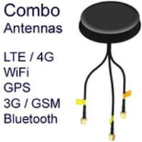
GPS antennas are often installed in combination with Long Term Evolution (LTE or 4G) antennas. In this setup, a GPS antenna is used as an auxiliary antenna that improves the Multiple Input, Multiple Output (MiMo) performance of the LTE antenna with improved stability, reception, and throughput, with minimized interference. The antennas are paired by using the LTE-main and LTE-AUX coax connections on the LTE antenna.

GPS antennas have a wide range of navigational and mobility applications and are often mounted on vehicles for navigation while on the move. The antennas may be:

  • Patch antennas consist of a metal patch mounted on a ceramic substrate that is typical of puck-style antennas
  • Quad helix antennas that are comprised of a number of longitudinal helices.

Both antennas are omnidirectional antennas.

They are typically positioned on the roof of vehicles to allow clear sky access and minimize interference from the vehicle's metal frame. They may be attached using a robust magnetic-mount, with the antenna screwed into the attached base, adhesive mounting (which may or may not be temporary) or be through-hole mounted, with the antenna passed through a pre-drilled hole to be set in place securely.

GPS Antennas

GPS Antennas:

Marine Grade options: All of the styles in our GPS antennas category that are "vehicle mount" type are suitable for marine, because they attach flush to a flat surface and have a durable ABS radome: The "puck" styles and also the cone style: ALGLNA2c3FT/ 9ft /18ft:

Frequency Bands

The signals produced by GPS satellites comprise ranging signals and navigation messages which provide time and spatial data. This data can be received by GPS antennas operating on the following key frequency bands (nb. there are additional legacy bands and modernized signals) which are available for civilian use and are derived from the fundamental frequency of the atomic clocks contained on the orbiting satellites:

  1. L1 1575.42 MHz and of 15.345 MHz bandwidth
  2. L2 1227.6 MHz and 11 MHz bandwidth
  3. L5 1176.45 MHz and 12.5 MHz bandwidth

Conversion to Iridium Satellite Coverage: For all of our antennas that cover the GPS frequency 1.5GHz: We can convert the 1.5GHz GPS antenna to 1.6GHz in order to cover the Iridium (Satellite) frequency. This customization takes about 4 extra weeks in production and will increase the cost of the antenna by $1.75 per antenna.

GPS Antennas

Global Positioning Satellite (GPS) Antennas are radio-frequency devices that are designed and configured for the receipt and amplification of the microwave signals that are transmitted by GPS satellites.

The GPS signal received is converted by the antenna into an electronic signal which can be utilized as navigational data by a GPS receiving device to compute a position.

GPS is primarily a proprietary military satellite-dependent radio-navigation system, owned by the United States Government and operated by the Federal entity, the United States Space Force. First implemented in the 1970s, the project has grown and matured to support up to 31 actively orbiting satellites, with global coverage and pinpoint accuracy of within 30 centimeters (11.81 inches).

Originally known as Navstar GPS, this system is one of a number of Global Navigation Satellite Systems (GNSS) that are available worldwide with military, and civilian applications, including emergency services, marine, automotive and aviation. Civilian access to GPS is at the discretion of the US Government and can be limited and withdrawn at their discretion with notable periods of selective accessibility or degradation of the service in previous years.

GPS is not the only satellite-based radio-navigational system in existence. The following are other GNSS that also have compatibility with GPS:

  • GLObal NAvigation Satellite System (GLONASS), a Russian system that is currently the main alternative to GPS. GLONASS and GPS radio-navigational data can be used simultaneously by GPS antennas meaning that a larger number of satellites are available for positioning and locations can be pinpointed with more speed and accuracy.
  • The Galileo Positioning System developed by the European Union. Upgrades to the GPS system allows interoperability with Galileo.
  • BeiDou Navigation Satellite System from China.
  • NAVigation with Indian Constellation (NAVIC)developed by India.

The data transmitted on the GPS frequencies include:

  • Ephemeris data - positional data for each orbiting satellite.
  • Almanac - data on the status of the GPS satellite constellation as a whole.
  • Pseudorandom noise (PRN).
  • Precision code or precision positioning service.

The L frequency bands involved are able to penetrate the atmosphere, clouds, precipitation and vegetation and GPS antenna can receive precise data at any time of day or night. Concrete and heavy vegetation may degrade the GPS signal and lead to inaccuracies.

The sub 2 GHZ frequencies used in the L bands minimize ionospheric delays. Also, the bandwidth for GPS is adequate to carry the PRN codes.

GLONASS also uses similar frequencies, hence its compatibility with GPS and its ability to be utilized by GPS antennas.

Low Noise Amplifiers (LNAs) can be used to enhance a GPS signal. These devices work to amplify the GPS signal without increasing any noise that accompanies it. A GPS antenna will have a Minimal Discernible Signal (MDS), and the antenna can be made more sensitive by LNA that contributes minimal noise with added gain to amplify the signal. They are a common feature of GPS antenna setups.

GPS antennas are often installed in combination with Long Term Evolution (LTE or 4G) antennas. In this setup, a GPS antenna is used as an auxiliary antenna that improves the Multiple Input, Multiple Output (MiMo) performance of the LTE antenna with improved stability, reception, and throughput, with minimized interference. The antennas are paired by using the LTE-main and LTE-AUX coax connections on the LTE antenna.

GPS antennas have a wide range of navigational and mobility applications and are often mounted on vehicles for navigation while on the move. The antennas may be:

  • Patch antennas consist of a metal patch mounted on a ceramic substrate that is typical of puck-style antennas
  • Quad helix antennas that are comprised of a number of longitudinal helices.

Both antennas are omnidirectional antennas.

They are typically positioned on the roof of vehicles to allow clear sky access and minimize interference from the vehicle's metal frame. They may be attached using a robust magnetic-mount, with the antenna screwed into the attached base, adhesive mounting (which may or may not be temporary) or be through-hole mounted, with the antenna passed through a pre-drilled hole to be set in place securely.